")
You want to build?
As surveying engineers, we will support your project through all of its phases: from the planning phase (site plan) to the construction phase (setting out, horizontal and vertical control). After completion, we will also ensure that the necessary Land Registry obligations are fulfilled (building surveys).
- Official site plan
A written application must be submitted to the supervisory authority for all construction projects that require building permits. Every building permit application must include an official site plan.
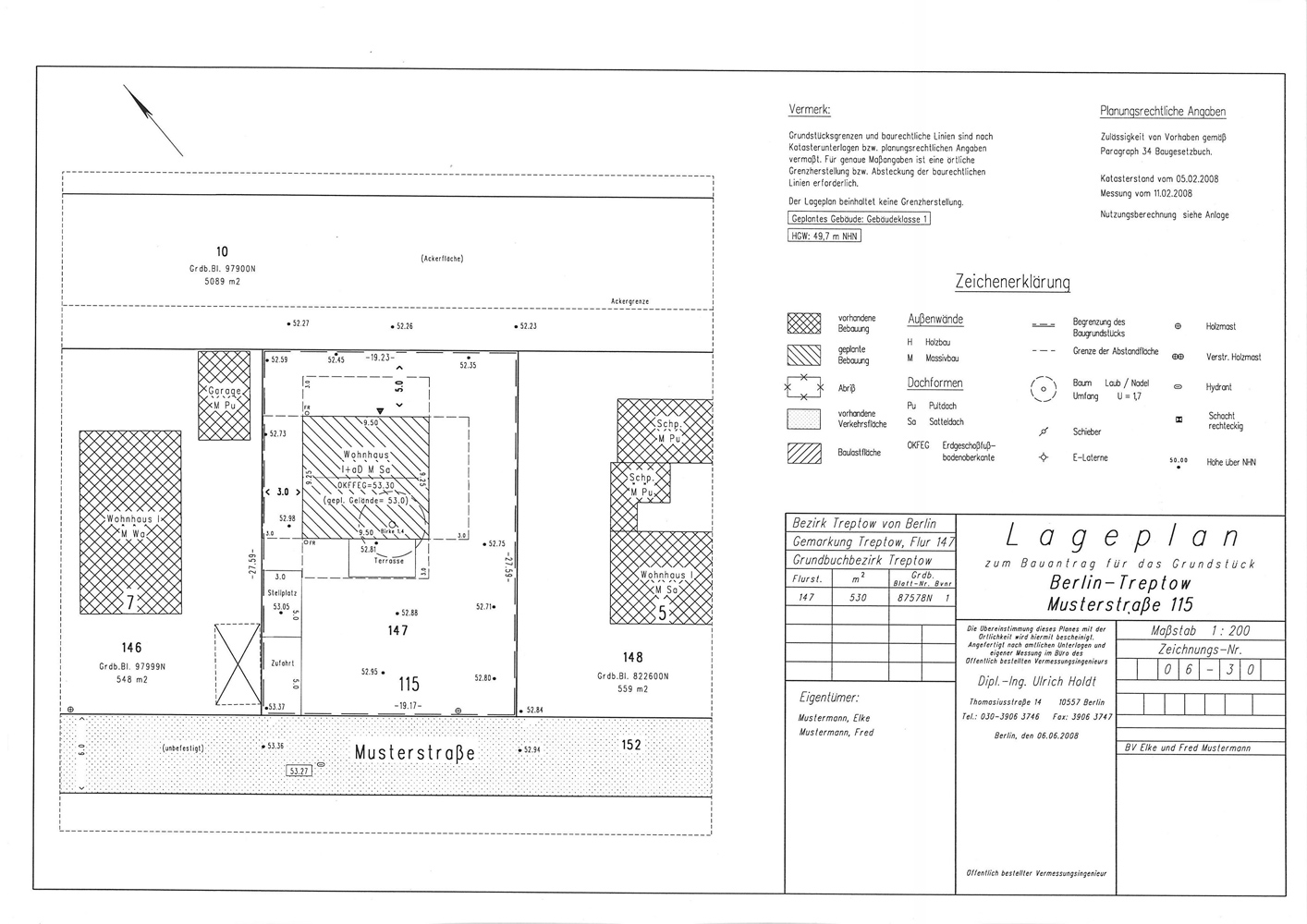
As a basis for the architect's planning work, the surveyor's first step is to draw up a site plan of the property representing the as-is cadastral situation and including data relevant under planning law as well as topographical details that impact on planning work. In consultation with you, his client, your architect will then plan your project and determine the horizontal and vertical position of the building on the property. The public surveyor enters the project in the site plan. He calculates clearances and land use ratios. With his seal, the public surveyor then certifies the accuracy of the cadastral presentation, the correctness of the statements made in respect of building and planning laws and the conformity of the documentation with the facts on the ground.
The result of this work is then the official site plan (sample site plan).
- Setting out the excavation (rough setting out)
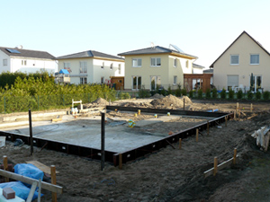
Once a building permit has been granted, the planned geometry of the building must be transferred to the situation on the ground (setting out). For buildings with cellars it is particularly important to correctly set out the excavation (rough setting out), as every cubic metre of soil excavated without need causes unnecessary expense. The building pit is pegged out, and a benchmark, or altitude reference point, is set.
- Accurate setting out
Once the building pit has been excavated or, for cellarless buildings, once the building surface has been planed, the outside corners of the building and the planned axes are transferred to the situation on the ground (accurate setting out). Accurate setting out is normally done by hammering nails onto a batter board set up by the construction company or by setting stakes with nails.
- Certification of horizontal and vertical position
A building authority may require the developer to submit a certificate from a public surveyor confirming that the project complies with the position and height specifications of the building permit (certification of horizontal and vertical position).
Surveying for the issuance of this certificate should ideally be done as soon as the masonry has been set on the floor slab; this ensures that potential construction faults are recognized as early as possible.
- Building surveys for the cadastral records
To ensure that official maps (cadastral maps) are kept up to date, the Berlin Surveying Act obliges owners and project developers to have surveys made of newly erected buildings and of existing buildings whose floor plans have been altered. In building and planning law, up-to-date cadastral maps are important decision factors for infrastructure measures and municipal planning. District surveying offices use survey reports drawn up by publicly appointed surveying engineers to update their local cadastral maps. The owner of a construction project receives a copy of the final product, the updated cadastral map.